WINTER WEATHER UPDATE JAN 5TH 2017
Hey everybody, How's it going!? You know I try to make this as professional as possible, but BEING ME (Omarr Wilson) is DRAINING..... I wish y'all understood LOL! But I digress! FIRST WEATHER UPDATE OF 2017!!!! Starts with FUN! The WEATHER is the Developing Story right now so Let's get to it!
What's going to Happen!? ........ Okay so what we have is an Artic Trough Diving South through the Plain States, and at the same time, we have a System pulling moisture North from the Tropics. It's SIMPLE, mix Artic air with Moisture, and What do you have? SNOW CITY.
What does the Models Say?....... Lets start with the GFS (Global Forecasting System).


What's going to Happen!? ........ Okay so what we have is an Artic Trough Diving South through the Plain States, and at the same time, we have a System pulling moisture North from the Tropics. It's SIMPLE, mix Artic air with Moisture, and What do you have? SNOW CITY.
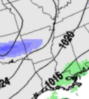
What does the Models Say?....... Lets start with the GFS (Global Forecasting System).

This is a Screenshot of the GFS Early Tomorrow Morning, you see precips starting to move into the State.

This is the GFS Tomorrow evening (Cold air moves faster than Computers can understand so they slow it down, but in reality this image will be most likely Mid Morning tomorrow or Earlier than that.)

This is a Different Weather Model, this is the NAM (North American Model), 12noon Tomorrow and it shows a different Location and picture of where the Snow Bands will set up....
Now, this is just two weather models out of 4 that I primarily watch (GFS, NAM, CMC, EURO).. But these two paint an accurate picture of what I don't yet know, and what I do know. According to The Models, YES THERE WILL BE SNOW, Fair Accumulations (Enough to cause issues), Yes it WILL move in Tomorrow MORNING and Afternoon. What I don't know, Where will the Heavy Snow bands be......
What do I think? What's my Forecast? Well going with My Gut Computer Model, from what I gather, based off of what I can see, what I Know, and History. I'm saying If you're in Central Arkansas, Leave EARLY OR NOT AT ALL.... Or SLEEP AT WORK! Because when this stuff start falling it will Stack up on the Highways and Travel will be Impossible if Not DANGEROUS! Im talking 3-4 car Pileups (I'm not wishing nothing bad on anybody, but SOME OF Y'ALL CANNOT DRIVE! AT ALL.....) So Leave Early, call in, or just Stay overnight at work tonight... I'm NOT expecting a Snowstorm, I'm only expecting 1-2inches here LOCALLY AROUND LITTLE ROCK. But with that said, just know y'all cannot drive. Now, for everybody ELSE! The NAM model is trending NORTH, Which means folks from Little Rock on NORTH will get the Heaviest..... The GFS is trending SOUTH, which means from Little Rock on SOUTH will get the Heaviest.... So according to the maps it's EITHER OR! What I think is that the bands will setup in Oklahoma, move into West Arkansas, then Saturate Central Arkansas, and sink South with the Progression of the Cold Air. So I tend to believe the GFS More.
So far I've covered What, When, and where I expect, so now its on to HOW MUCH!!!! I DO NOT expect us to have the TIME for Major accumulations mainly due to the Speed of the System, but it will be here just long enough for us to collect at least an Inch to 2.5Inches in some Locations. Again that's for West, Central, and South Arkansas (MY PREDICTIONS). That doesn't mean Sections of North Arkansas won't get anything bc I think they will Later tonight, and Early tomorrow morning (After Midnight). But the Main bands will be More towards Central, and West, and South regions.

This Map is Courtesy of The National Weather Service in North Little Rock, and in a Nutshell this Sums up everything I just said. They just didn't mention Numbers, again I expect 1-2",not quite 3" but it's possible in the lower areas. I expect this in a Band a across the State from West Arkansas, Through Central, to East Arkansas and a distance South as Well. How South Idk? Maybe as Far as Pine Bluff. Who Knows! It's Arkansas LOL!!!
Well that's my Official Update and Forecast, I hope I've answered All of Your Questions, if you have anymore questions Please feel free to Comment on this Update, or on Facebook or Twitter, or Message me! Thanks for Coming here to The Arkansas Weather Hawk's Blog!!
Follow Me on Social Media
@Omarrian Wilson -Facebook
@Omarr Wilson -Twitter
@The Arkansas Weather Hawk -Google Plus


Comments
Post a Comment