Posts

Showing posts from December, 2018

Official 2018 Christmas Forecast

Image
       Hey everybody how's it going!? I hope everybody is having a fantastic night so far, I hope everybody has had the opportunity to get all of their Christmas shopping in, the stores have been crazy, and the good thing is, the weather has been cooperating for the last few days, and that's has been very appreciative to say the least. Now the question is, will it stay like this? I have your answers below.!       Okay, so as far as rain, the GFS has it dry through Christmas, which is a change from days, to weeks ago. I don't totally buy it at the moment, I don't think the entire state will be dry, Little Rock? maybe! Or, maybe a scattered shower early in the day, but for areas in North, and West Arkansas, there is a chance for showers early in the day on Christmas, the latest NAM shows it. Now, weeks ago the GFS was showing snow for Christmas, I did an update about that showing that it was in the realm of possibilities, but you see how probable that is at this point. T

PRELIMINARY Christmas Winter Weather Forecast

Image
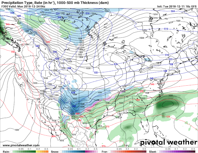
      Hey everybody, how's it going? I hope everybody is having a fantastic day so far! I've been watching the GFS very closely over the last 6-7 model runs, and I've been watching something fairly interesting over the last few runs. The GFS has been fairly consistent with the possibilities, but inconsistent with the exact time, and locations as to be expected from 300+ hours out into the future. But from this far in advance the GFS is fairly consistent with the possibilities. So let's take a quick look shall we!? This is the Tuesday noon run of the GFS (Global Forecasting System) weather model, and as you can see here, the GFS has a system moving in from the Southwest, and a arctic front moving in from the Northwest , combine those two, and this is the obvious possibility. But this image has changed in location, and time over the last 4-5 runs, so it will change much more over the next. But this particular model has been consistent with this particular outcome, or

WINTER WEATHER UPDATE: 12/8/18 Saturday Snow

Image
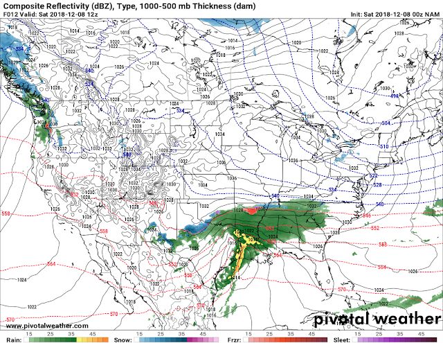
       Hey Everybody, how's it going!? I hope everybody is having a fantastic night so far, and I hope all has been well. Of course we have a developing Winter Weather situation coming together here in the state, and everybody except Santa Claus has made an update about it, everybody has thrown their spin, and two cents in about whats going to happen tomorrow. Now for mine!       As fas as the What? Im expecting an initial changeover to Freezing Rain/Sleet from a cold rain, then changing over to Snow.  For some areas I'm expecting sleet/freezing rain changing over to snow LATE Saturday. For certain areas I'm expecting mostly a cold rain, POSSIBLY changing over to Sleet LATE SATURDAY. As Far as how Much, well the Models are projecting 4-6" up north of Searcy, and 2-4" around Searcy - Clinton. A dusting to a trace for Central Arkansas if that. This is the Latest run of the NAM it shows the Initial changeover to sleet by 6am tomorrow morning in north central Ark

WINTER WEATHER UPDATE: Late Week White Stuff??

Image
      Hey everybody, how's it going? I hope everybody is having a fantastic day so far! Following Friday's severe weather event, I want to thank EVERYBODY for taking heed to watches, and warnings, and my continuous severe weather coverage on social media. Now getting past that, I've been noticing some chances for Winter Weather next weekend on the GFS (Global Forecasting System), one of the Weather Models I monitor, and study. The GFS is a 384 Hour forecast model, that I tend to look at for long range events, especially during the winter. About 132 hours out by next Friday the GFS has been consistent on a frontal boundary moving in along with a cold dip in the jet stream from the north, with it brings rain of course, but the GFS has been hinting on a chance for a changeover in North Arkansas mainly, but I cannot rule out a BREIF changeover further south possibly into North Central/Central Arkansas. See Pics Below. This is the latest run, the 18z Noon run of the GFS. The