Posts

Showing posts from February, 2021

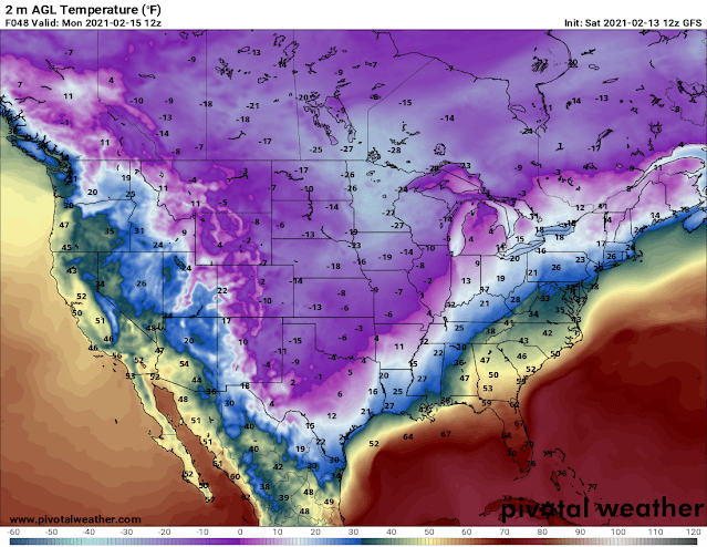
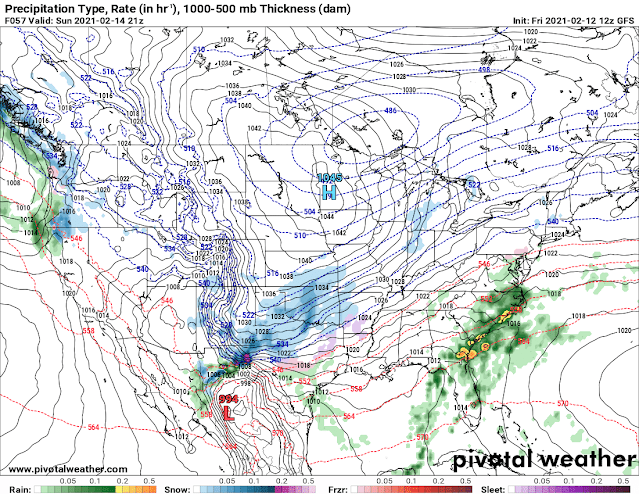
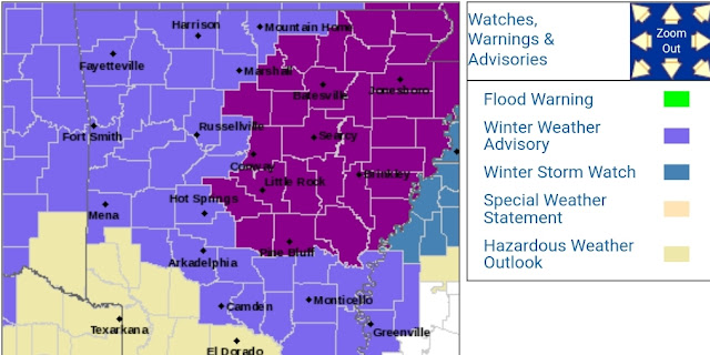
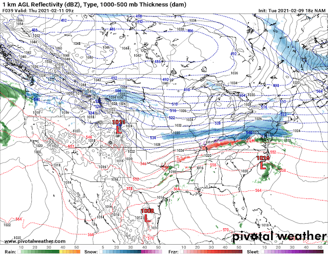
Winter Weather Update: Arkanrado Snowmageddon

Image
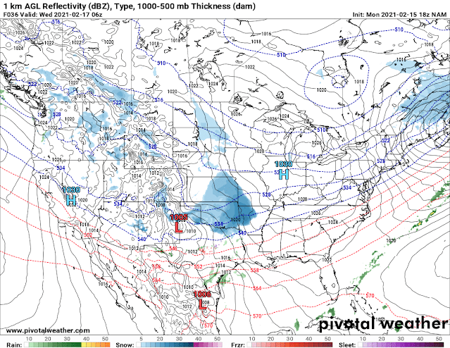
       Hey Everybody, I hope all have been safe during this Polar Express. I know some people "Have No Choice" but to drive to work regardless of the weather, which I think is ridiculous, because risking your life is always a choice... But However, in the Process of making it to work, I Hope and Pray that Everybody is safe and Sound, and Unharmed. I have seen lots of Video's on Social Media of people Speeding down the highway...... That's how Car Crashes happen, that's how Lives are Lost. SLOW DOWN ON THOSE ROADS! Your Jobs are Not going to go anywhere, nor is speeding in the Snow going to get you there any quicker. So SLOW DOWN ON THOSE ROADS.         Now On to Round #2! But before that, Areas around Central Arkansas and Points to the West and South got Big time Snow totals, that just goes to show you that Regardless of how accurate we try to make forecast, they are not perfect, and wherever the Snow Bands setup are pretty random. Weather Models are good, but not

Winter Weather Update: New Model Guidance!!! More Snow!!

Image
        Hey Everybody, I hope you all have everything you need for the next several days because we are on track to get way more snow than we have! As of right now, making this post, I measured 1" of Snow outside my house here in West Little Rock. Now, there has been some updated images from 2 different models that I tend to study very closely. The GFS (Global Forecasting System) Weather Model is sticking to the original idea of all the heavier totals being confined to Southeast Arkansas. But Models like the NAM (North American Model), and HRRR (High Resolution Rapid Refresh) models are bringing higher totals back up into Central Arkansas. Check Below. This is the NAM (North American Model), this is Valid out to Midnight Overnight tonight, this shows a Second Band of Snow Moving up the I-30 Corridor and into Central Arkansas. Some of these Convective Bands of Snow could be Moderate to Heavy in intensity.  This is the NAM in between the Hours of 3am and 6am tomorrow morning. This i

Valentine's Day Eve 2021 Winter Weather Update

Image
        Hey Everybody! Happy Valentine's Day Eve 2021! I have a Feeling I'll be doing another Update tomorrow about this storm. But since the Very Basics of the Storm was Covered in the Last Update, I will only go over the Changes between Yesterday and Today in this one, that way I'm not repeating myself. If you haven't seen the Last Update "Winter Weather Update: ANTARCTIC Express???," You should DEFINITELY check it out for sure! Like I said, not much has changed, the Models are disagreeing about the Onset of when everything Starts, they're also disagreeing with intensity, and exactly where the Snow Bands setup, which is typical, they usually don't agree until the day of, then they'll line up.  They also don't agree with Temperatures. The NAM (North American Model) is warmer on Tuesday Morning than the GFS (Global Forecasting System), and the EURO (European Weather Model).  This is the GFS surface Temperature Map, this has us at 11° here in Ce

Winter Weather Update: ANTARCTIC Express???

Image
         Hey everybody, how's it going everybody? I hope Everybody is remaining warm, and safe today. Most of the Ice from Yesterday's Storm is gone, but however we have more winter Weather coming, TO SAY THE LEAST!!!! I have never seen Subzero Temperatures here in Arkansas in my 28 year old life.... Not that I can remember  anyways. But It's looking like a true possibility here in Arkansas, and Central Arkansas. Let's just get right too this.         Now as far as Sunday goes, what's New? Well Both the NAM, and GFS Models wants to bring in an early Wave of Precipitation on Sunday Morning, and afternoon. The GFS has everything very scattered with Majority of the Precipitation in West Arkansas up until Sunday Night, into Monday Morning. The NAM wants to bring an entire Wave of Moisture through on Sunday Afternoon, then another wave overnight Sunday and Into Monday Lasting through Monday Afternoon before getting out of here.  This is the Latest Run of the GFS (Global

Developing Winter Weather Update: Winter Storms 2 & 3!!!

Image
       Hey Everybody, How's it going? I HOPE that all of my Loyal Followers are SAFE, Right? I HOPE that Everybody that has read my Updates actually listened to what I said, and Stayed off those roads. I was driving around Midnight this Morning when the Freezing Rain started in the Little Rock area, at that time Temperatures were still a little elevated, the roads was just wet. But After about 3am, Everything went downhill when those Frozen Storms moved in! ThunderSleet is a Once or Twice In a Lifetime Phenomenon, it's not something you normally see, and whenever you do see it, it's usually never a good sign of what's happening at that moment. Frozen Storms tend to produce very high accumulations of Ice, and it causes very Crippling issues the longer they last. Thankfully for us, the Frozen Thunderstorms didn't last Long.         First I want to Take a Moment and Wish My Condolences to ALL of the Victims of the Major Car Accident in Fort Worth Texas this Morning. I

Winter Weather Update: Winter Storms 1 & 2

Image
        Hey everybody, I hope Everybody is remaining safe today. This morning we had some freezing Mist/Fog around Central Arkansas, and North. That freezing Fog Did cause some issues on the roads this morning in the Little Rock Metro, now that was nothing, we have what appears to be Two Storms on the Horizon. I'm going to bring everybody up to speed on Tomorrow (Thursday, February 11th), then we'll talk about Sunday, and Monday.           Okay, Now for tomorrow, what's new? Well not a lot has changed between yesterday and today, only a few things. So Storm Prediction Center has Issued an Ice Storm Warning for Central Arkansas. It is highly anticipated that areas in Central Arkansas will get between a quarter to a half inch of Ice, confidence in that happening got stronger which prompted the Ice Storm Warning. The Temperatures are projected to be between 27-30° here in Central Arkansas, if that happens then we are talking about some serious Power and Tree issues here around

Winter Weather Update: February 9th 2021

Image
        Hey Everybody! I hope Everybody is Staying safe on this cold, damp, and wet Tuesday. It looks like there is a chance for some serious weather to be moving in over the next 24-48 hours, that will create some very dangerous driving conditions on the Roads here in Arkansas. This is an Ice System, I don't see much potential for Snow as much as I do Sleet and Freezing rain. I Love Snow personally, Snow is great for pictures, and fun in the winter. Snow Does make the roads Slick, and Slippery, especially when you get a lot of it. But Ice is a completely different beast all together from snow. Snow doesn't Stick to Tree's and Powerlines, Ice does. Ice will cover the roads and make them one solid Sheet of Pure Ice, and on Ice you have ZERO traction. You can Drive in Snow, Snow is Decent to drive in, but ICE is a No Go. Ice will shut a City down within Minutes. Ice will cover everything, bring down Tree's, powerlines causing outages for extended periods of time, and not