Winter Weather Update: Winter Storms 1 & 2
Hey everybody, I hope Everybody is remaining safe today. This morning we had some freezing Mist/Fog around Central Arkansas, and North. That freezing Fog Did cause some issues on the roads this morning in the Little Rock Metro, now that was nothing, we have what appears to be Two Storms on the Horizon. I'm going to bring everybody up to speed on Tomorrow (Thursday, February 11th), then we'll talk about Sunday, and Monday.
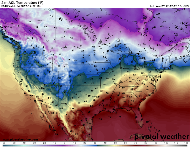
Okay, Now for tomorrow, what's new? Well not a lot has changed between yesterday and today, only a few things. So Storm Prediction Center has Issued an Ice Storm Warning for Central Arkansas. It is highly anticipated that areas in Central Arkansas will get between a quarter to a half inch of Ice, confidence in that happening got stronger which prompted the Ice Storm Warning. The Temperatures are projected to be between 27-30° here in Central Arkansas, if that happens then we are talking about some serious Power and Tree issues here around Central Arkansas and areas to the North and East. If temperatures go below 30° we're looking at easily a Major Ice Storm, this can cause power to be out widespread, for extended periods of time. I HIGHLY DOUBT Temperatures will get above, or Near Freezing on Thursday, so this will stick around.
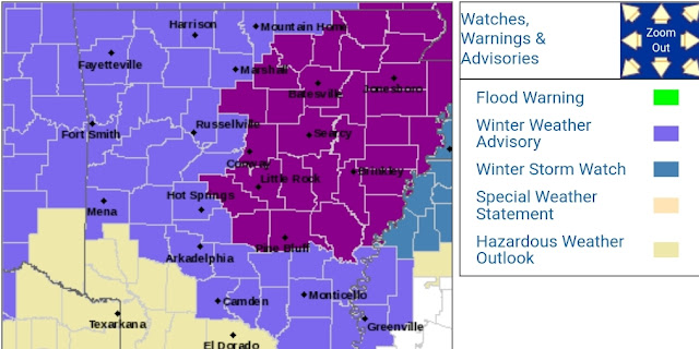
This is the Latest Watch/Warning Map. Winter Storm Watch for Majority of the State Except Southwest Arkansas. The Purple Shaded Area is that Ice Storm Warning, this extends through Thursday.
This Map is Courtesy of The National Weather Service in North Little Rock. This is the Ice Accumulations Totals of what's expected to come through tomorrow afternoon. As you can see, from Central Arkansas on East there's projections for .25 to .50 of an inch of Ice Accumulations. If the Temperatures in that Red Shaded Area are 30° or Lower, this can be a potentially Crippling Ice Storm.
Now On to Our NEXT Winter Storm. There's yet another chance of Winter Precipitation in Arkansas on Sunday, and into Monday during the Day/Afternoon. I have some pictures of the GFS (Global Forecasting System) weather model.
This the GFS Weather Model Valid between the Hours of Midnight and 3am Monday morning, this shows the Onset of everything to come.
This is the GFS at Monday Morning between 3 - 6am as you can see, everything is projected to start as Sleet/Freezing Rain, then transition over to Snow as the morning goes along.
This is the GFS between 6 - 9am Monday Morning, the Snow/Sleet/Freezing Rain gets more intense in Coverage as the morning goes along.
This is the GFS out to Noon on Monday, and it's still very intense on the Snow in Central Arkansas.
Now this is still a Good 4 - 5 Days into the Future, this is NOT SET IN STONE, so don't take this to heart just yet! Now, with this system the cold air will already be in place, so whatever start will already frozen due to the Temperatures. THIS MAY START AS EARLY AS SUNDAY. But once again, all of this is speculation up until about Saturday afternoon.
Thanks for Coming here to the Weather Hawk's Blog, Stay Safe Everybody! Subscribe to the blog for email updates, and share!


Comments
Post a Comment