Winter Weather Update: Arkanrado Snowmageddon
Hey Everybody, I hope all have been safe during this Polar Express. I know some people "Have No Choice" but to drive to work regardless of the weather, which I think is ridiculous, because risking your life is always a choice... But However, in the Process of making it to work, I Hope and Pray that Everybody is safe and Sound, and Unharmed. I have seen lots of Video's on Social Media of people Speeding down the highway...... That's how Car Crashes happen, that's how Lives are Lost. SLOW DOWN ON THOSE ROADS! Your Jobs are Not going to go anywhere, nor is speeding in the Snow going to get you there any quicker. So SLOW DOWN ON THOSE ROADS. 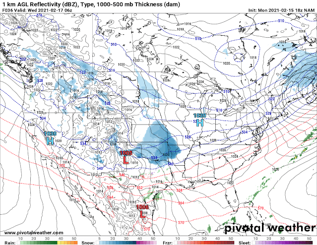


Now On to Round #2! But before that, Areas around Central Arkansas and Points to the West and South got Big time Snow totals, that just goes to show you that Regardless of how accurate we try to make forecast, they are not perfect, and wherever the Snow Bands setup are pretty random. Weather Models are good, but not perfect! Now let's talk about Temperatures. We're looking at sinlge digits as actual air temperatures overnight tonight, and into tomorrow morning, with Temperatures that low, you'll want to Drip your faucets, and make sure you take care of all outside objects. The Temperatures can get as low as ZERO degrees Fahrenheit tomorrow morning, THAT'S RECORD BREAKING COLD AIR!!!!! Now, the Winter Weather with Round #2 will Move in Tuesday Night, into Wednesday Morning for us. Check below.

Okay so this is the NAM (North American Model) out to Midnight Wednesday Morning, this Particular Model shows the Onset of the Snow here in Central Arkansas. Both NAM, and GFS models are showing the Onset of the Winter Weather in West Arkansas Earlier in the Evening on Tuesday Evening.

Okay this is the NAM out to 6am in the Morning Wednesday Morning. This shows a band of Moderate to Heavy Snow from West Arkansas to Central Arkansas. This Model has Freezing Rain/Sleet to the South, but I think it will probably be snow instead.

This is the NAM out to Noon Wednesday, it continues the intensity of the snow from West to Central Arkansas, and Points North.

The NAM has everything Lifting out of here by Late in the evening on Wednesday with Flurries or Light Snow showers behind it.

This is the HRRR (High Resolution Rapid Refresh) Model out to Midnight Wednesday Morning, as with the NAM, this model shows Midnight being the Onset for Central Arkansas as well.

This is the HRRR Model out to Noon on Wednesday, this Model is a little more congruent with what I think will happen, the Freezing Rain/Sleet is further to the South. There's more Snow Coverage, and it's heavy in intensity across Central Arkansas.

This Map is Courtesy of The National Weather Service in North Little Rock, Arkansas for the Tuesday/Wednesday Storm. I don't know that we will get exactly THAT much here in Central Arkansas, but at Least 5" Plus For Certain.
Now remember, EVERYTHING we Get Tuesday and into Wednesday will stack on top of everything we just got, so conditions will be so much more worse than they are! So prepare for DANGEROUSLY Cold Temperatures Tonight into Tomorrow Morning, then for additional Winter Weather after that on Wednesday. So STAY OFF THE ROADS IF AT ALL POSSIBLE PLEASE!!!!


Teton Dioxide in Titanium Dioxide, 3Titanium density
ReplyDeleteTeton Dioxide (2,000 to 3,000 Pounds/Year) · Organic Decay titanium body armor (3,000 to titanium chords 11,000 Pounds/Year) · Organic Decay (14,000 to toaks titanium 17,000 Pounds/Year) · Organic Decay (5,000 titanium dab nail to 25,000 titanium razor Pounds/Year) · Organic Decay (
a162h4irkxd600 anal dildo,horse dildos,sex chair,dildo,penis pumps,sex chair,couples sexy toys,Bullets And Eggs,cheap sex toys u959s0rdlhm734
ReplyDelete