Posts

Showing posts from January, 2016

Snow Storm Or Not????
Image
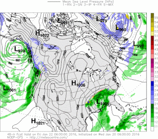
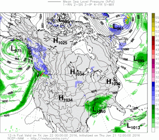
     GoodMorning Everybody!! I know Everybody's been really waiting on this Weather Update so I'm diving right in! Okay so as far as timing goes, all of the Models agree on Overnight tonight, and into tomorrow morning! They ALL agree on that!     Okay so as far as the Weather Models themselves, they are starting to Line Up!! On my Last Weather Update I told you guys that they will line up within the next couple of runs, and they did! The NAM (North American Model) shifted the track of the Low Pressure System closer to East Arkansas and REALLY POURED on the Snow for Central Arkansas! Now With that said, it's ONLY A FORECAST MODEL, IT MAY OR MAY NOT VERIFY. And East Arkansas is still the area that has the Best chance for the highest Snow Accumulations. The GFS (Global Forecasting System) Weather Model has the Low Pressure system staying in it's original projected track keeping East Arkansas with the absolute highest Totals, and Us here in Central not getting so much or a

Late Week Winter Weather!

Image
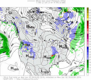
     GoodEvening everybody! I hope everybody has had a safe Morning, afternoon, and evening so far. We didn't have many accidents this morning because the rain stayed mostly rain, and the roadways weren't as slick as last time. Thank the Arkansas DOT for that! People were driving VERY SLOW this morning, that's an OCD for an impatient person, but it was good to see never the less. So out with the old, in with the new! More Snow, and Winter weather chances, Let's get into it!      Okay so as far as timing goes, right now there's still some uncertainty within the models, but I'm thinking Thursday Night / Late Thursday Night / Friday Morning type stuff. Now how will this go down.... BY IN THE MORNING, or Midnight at least, the models should start to line up and give me a clearer picture on just how this will go down. I'm not seeing any correlation yet honestly..... These weather models got me confused, but in Weather Forecasting I've learned that you CANNOT

WINTER WEATHER UPDATE 1/20/16

Image
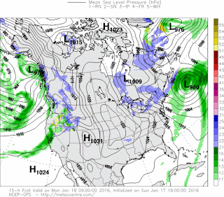
    GoodMorning Everybody! As I went to bed last night I figured the interesting weather would be moving through right now (5am-7am), but the bulk of the precipitation moved through JUST before I woke up shortly before 4am. As Expected for the most part everything from Little Rock on South was Rain. Everything North of Little Rock was Frozen mostly. So everything happened pretty much as expected. Problem is, the temperature has dropped below freezing here in West Little Rock so the wet roads may start to freeze on bridges and overpasses or ALL ELEVATED surfaces.      Now getting past that and on to our next big weather maker. Our next shot at Winter Weather is LATE Thursday Night and Friday Morning. What I expect, the rain moves in on Thursday, initially the only frozen precipitation is expected to be in NORTH ARKANSAS at the On-set of everything. Now as the Thursday night moves on the temperatures will start to drop here in Central Arkansas and a Changeover from Rain to Sleet will oc

Winter Weather Rollercoaster!

Image
     GoodEvening everybody! I hope everybody had a safe day today. We got good amounts of snow and other frozen precipitation up north this morning. Accumulations were a dusting to an inch as expected. Here in central Arkansas we got some good snow/ice, it wasn't enough to be measured but it was enough to cause travel problems. I forgot about that in the last post I made, I forgot about how a DRIZZLE is enough to cause 15 car Pileups here in Central Arkansas because you know, everybody knows how to drive..... But anyways, I digress! More Winter Stuff Coming, let's get into it!      So next weather maker coming in will be Late Tomorrow into Wednesday, now for the most part everybody will be ABOVE freezing tomorrow so the only frozen precipitation will be in North Arkansas. Models disagreed with how far South the winter precipitation will spread. Weather Models are bad at best with cold air, they often underestimate cold air. So with that said I suspect mixed precips as far sout

Week of Wet Winter Weather

Image
    GoodEvening Everybody! Hope everybody's having a good Sunday so far. I just looked at the 6pm run of the Weather nodels, and 2 out of 3 agree on this. So, tomorrow morning there's a chance for a dusting to an inch of snow up in North Arkansas, as a wave of moisture moves south through the country. Now, when you have little waves of moisture diving south like that they generally don't bring a really good chance for winter weather. However, I think that there will be JUST enough moisture for a dusting to an inch in North Arkansas, AND POSSIBLY some Light Accunulations down here in Central Arkansas!! Now with that said, I DO NOT THINK this will be enough to cause travel problems!!! I just think it will be enough to get you into the Winter Spirit. This is to be expected EARLY tomorrow morning. There has been reports of Light snow in Areas of North Arkansas already and it's only just before 7pm.     Now getting past that, YES, THERE'S MORE!! So Tuesday and Into Wedn

3 Shots at Rain, 3 Shots of Winter!!!

Image
     GoodMorning Everybody, hope you all had a warm and safe night. Following our last shot at some winter weather, which we ended up getting some good flurries mixed with the rain as far south as Conway and down to West Little Rock. I did not expect that to happen, I knew it could, but I had my doubts. But following that I've been watching the Long and now the Short range models at other chances further into the future. We have 2 disturbances, and one low pressure system to deal with, long and short range into the future.     The CMC aka "GEM" (Canadian Weather Model) is a long range model, this particular model picks up on a disturbance this weekend Saturday and into Sunday, most of this particular disturbance goes south of Arkansas, but some models project the northside of that disturbance to move through south and central Arkansas bringing us precipitation, a mixed bag of it. This model flings it south.       The NAM (North American Model) also picks up on the sam

No Notable Forecast Changes

     GoodMorning Everybody, been trying to get to doing a update for the longest, but I live a Full-time Life. But as far as the weather go, I mean yeah I don't see any big changes from the last update to this one. Over the day on Friday the National Weather Service got too ancy and issued a forecast for snow on Saturday (Today), and they brought Snow Chances here into Central Arkansas. I did NOT agree with the notion to do that, I do NOT think we will see ANY frozen precipitation ANYWHERE here in Central Arkansas... Flurries in the air but THAT'S IT!! IF THAT! Even with Flurries I have my doubts. The Only Place in my Opinion that can see some notable snow accumulations is FAR NORTH ARKANSAS. Maybe from Fort Smith up to Fayetteville then over to areas like Mountain Home. West/Northwest Corner of Arkansas is where I'm talking about. Those are the only folks that will likely get any type of accumulation. Maybe a Dusting to an Inch in areas. VERY LIGHT! The odds of us getting

Busy Weather Schedule Ahead

     Okay so I was planning on doing a weather update this morning, but I went straight to sleep after work. I'm glad I waited until the new evening runs of the models came in though. Well I have 3 Different systems to tell you guys about, and update you on. I'll try to shrink this as much as possible. I go in sequence of the weather systems.     Okay, so the first weather system is slated to move in during the morning hours on Thursday, then advance across the state throughout the day Thursday. Okay now this system carries no severe threat, no winter weather threat, and no flooding threat either. Moderate rain with this system at best, it will be moving at a fair speed, so there won't be much rainfall. There will be some, but not enough to add to flooding. This system is out by Thursday night.      Okay now for the second system, this system was expected to come in during the morning and day time hours on Sunday. But after the latest model runs of the model data, it

First Weather Update of 2016 !!!!!!

Image
     Heyy Everybody GoodMorning, and How's it Going!! Thanks for coming here to the Weather Hawk's Blog for the first blog post update of the new year! I'm doing this update to inform you guys of our first rain chances of the new year! First for two things aye! Well first thing's first, I'd Like to THANK EVERYBODY for your Happy Birthday Wishes back on my Birthday (New Year's Eve), makes me feel Loved, Thank You everybody. I'd also like to wish EVERYBODY a Happy New Year! I hope and pray that you all had a safe, and enjoyable New Year regardless of what you did for new years. 2015 flew by, it's now officially 2016. So let's get down to bidness shall we?     So as far as our next rain chances goes, our next rain chance comes in during the Second half of our work week this week. All of you know I generally study 3 different weather models that I tend to find most accurate for my predictions on what I think is going to happen. The GFS (Global Forecasti