Week of Wet Winter Weather
GoodEvening Everybody! Hope everybody's having a good Sunday so far. I just looked at the 6pm run of the Weather nodels, and 2 out of 3 agree on this. So, tomorrow morning there's a chance for a dusting to an inch of snow up in North Arkansas, as a wave of moisture moves south through the country. Now, when you have little waves of moisture diving south like that they generally don't bring a really good chance for winter weather. However, I think that there will be JUST enough moisture for a dusting to an inch in North Arkansas, AND POSSIBLY some Light Accunulations down here in Central Arkansas!! Now with that said, I DO NOT THINK this will be enough to cause travel problems!!! I just think it will be enough to get you into the Winter Spirit. This is to be expected EARLY tomorrow morning. There has been reports of Light snow in Areas of North Arkansas already and it's only just before 7pm.
Now getting past that, YES, THERE'S MORE!! So Tuesday and Into Wednesday there's another chance for rain. Now I expect that to be all RAIN. But During the day Thursday and into Friday, there's a chance for rain, BUT there will be subfreezing air on the backside of that front, wrap around moisture will give us a adequate chance at some light Snow or at least a Mix POSSIBLY as far south as Central Arkansas. Now the Change over will be sometime in the Evening-Night on Thursday Likely Late Thursday night. But the models are still sketchy this far out. See pics below to see what I mean.
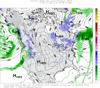


Now getting past that, YES, THERE'S MORE!! So Tuesday and Into Wednesday there's another chance for rain. Now I expect that to be all RAIN. But During the day Thursday and into Friday, there's a chance for rain, BUT there will be subfreezing air on the backside of that front, wrap around moisture will give us a adequate chance at some light Snow or at least a Mix POSSIBLY as far south as Central Arkansas. Now the Change over will be sometime in the Evening-Night on Thursday Likely Late Thursday night. But the models are still sketchy this far out. See pics below to see what I mean.

Now this is the GFS (Global Forecasting System) Model, it shows a light band of snow moving into Central Arkansas by tomorrow morning. Now this say by 9am, but here's a secret, Weather Models often underestimate the speed of cold air, so often times cold air, and frozen moisture moves in lots quicker. Early tomorrow morning I COULD be snowing here in Central Arkansas.

Now here's the GFS by Noon on Wednesday, as you can see just Plain Jain Rain, nothing fancy on Wednesday, that moves out by Wednesday evening, probably quicker.

Now here's the GFS on Thursday Night into Friday Morning, now this is valid in between 6pm Thursday night, and 12am midnight Friday Morning. It show's that within that time frame a change over to sleet is expected to happen in North Arkansas.

And this is the GFS in between 12am Midnight and 6am Friday Morning. It show's Snow and Sleet Showers in Northeast Arkansas, and possibly some snow showers in Central Arkansas.
NOW TAKE That Information about the System Later this week with a GRAIN OF SALT... The details to this will change, but this is what I got at this time. Predicting Winter Weather is really sketchy for anybody honestly because a 2° difference in temperature can mean the difference between getting snow, and getting nothing. So there are lot's of variables that come into play here. I will continue to keep you guys up to date on things as it change, I appreciate you all for coming here to the Hawk's Blog!
Follow Me On Social Media
TheArkansas WeatherHawk - Facebook
@OmarrWilson - Twitter
The Arkansas Weather Hawk - Google Plus


Comments
Post a Comment