Winter Weather Rollercoaster!
GoodEvening everybody! I hope everybody had a safe day today. We got good amounts of snow and other frozen precipitation up north this morning. Accumulations were a dusting to an inch as expected. Here in central Arkansas we got some good snow/ice, it wasn't enough to be measured but it was enough to cause travel problems. I forgot about that in the last post I made, I forgot about how a DRIZZLE is enough to cause 15 car Pileups here in Central Arkansas because you know, everybody knows how to drive..... But anyways, I digress! More Winter Stuff Coming, let's get into it!
So next weather maker coming in will be Late Tomorrow into Wednesday, now for the most part everybody will be ABOVE freezing tomorrow so the only frozen precipitation will be in North Arkansas. Models disagreed with how far South the winter precipitation will spread. Weather Models are bad at best with cold air, they often underestimate cold air. So with that said I suspect mixed precips as far south as maybe Newport or so, DON'T TAKE THAT TO HEART!!! That vary's depending on like 2-3° in any given location. But Newport as a educated guess. Everywhere south of there gets a COLD RAIN!!


So next weather maker coming in will be Late Tomorrow into Wednesday, now for the most part everybody will be ABOVE freezing tomorrow so the only frozen precipitation will be in North Arkansas. Models disagreed with how far South the winter precipitation will spread. Weather Models are bad at best with cold air, they often underestimate cold air. So with that said I suspect mixed precips as far south as maybe Newport or so, DON'T TAKE THAT TO HEART!!! That vary's depending on like 2-3° in any given location. But Newport as a educated guess. Everywhere south of there gets a COLD RAIN!!

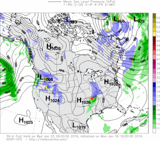
Now here's the GFS weather Model by 9am Wednesday Morning. Now due this will likely happen way earlier than 9am, earlier in the morning very likely. But as you can see, it keeps frozen precipitation up north, I pretty much agree with that, everybody else being a cold rain. I do however think a mix could happen further south in areas.

Now this is the NAM (North American Model) Model, this is for the exact same time Wednesday Morning, and as you can see, it shows a change over further south into Central Arkansas! This is the disagreement I was talking about within the weather models. I don't think the NAM is totally wrong! That's why I said, a chance for a change over further south on Wednesday Morning!
Okay, so now that we've got that system pretty much covered, lets get into the next system later this week.!
Okay so that system is slated to start moving in at some point during the day on Thursday. For the most part we are looking at just plain jain rain during the day Thursday and Thursday night. It is LATE Thursday night and Early Friday morning on the Backside of this system that brings us our next shot at winter weather. Cold air will be punching in behind this front, wrap around moisture will be in the area, so boom, there it is! Now this system may bring more substantial amounts of Snow/Sleet/Freezing Rain to some areas that may or maynot have seem much today.

Now this is the GFS Model valid in between 6am Friday morning and 12noon on Friday. At some point during that period of time according to this model this is what we got! Mor Snow, so this would give us higher amounts in Central and East Arkansas, IF THIS WAS TO VERIFY!!! Let me Make that Clear! We are still many days out, this may or maynot change.

This is the NAM weather Model during the hours of 12midnight on Friday morning and 6am Friday morning. It show's a significant band of moderate to heavy Sleet moving into Central Arkansas at some point during that time frame.

This is the NAM in between the hours of 6am and 12noon on Friday, it show's a significant band of moderate to heavy snow exiting out of Central Arkansas into East Arkansas! Again, IF THIS WAS TO VERIFY this could bring substantial accumulations to certain areas!!
Okay everybody, like I said last update, take this seriously, but don't take it word for word. There are LOTS of varibles that go into winter weather, and what types, and who gets it and who doesn't. A difference of a few degrees in temperature can tell who gets what and who doesn't. But based off of what I seen in the models, the above forecast is what I think will play out. This will change and I will keep you guys up to date as it does! Thanx for coming to the Weather Hawk's Blog everybody! Have a GoodNight!
Follow Me On Social Media
TheArkansas WeatherHawk - Facebook
@OmarrWilson - Twitter
The Arkansas Weather Hawk - Google Plus


IT DOES NOT LOOK LIKE A MAJOR SNOW EVENT BY ANY STRETCH BUT SOME
ReplyDeleteMINOR ACCUMULATIONS WILL BE ADDED TO PARTS OF THE NORTH. - AFDLZK
I agree. I don't think either system will be major or bring anything big. That second system could bring some measurable accumulations to Central Arkansas however.
Delete