First Weather Update of 2016 !!!!!!
Heyy Everybody GoodMorning, and How's it Going!! Thanks for coming here to the Weather Hawk's Blog for the first blog post update of the new year! I'm doing this update to inform you guys of our first rain chances of the new year! First for two things aye! Well first thing's first, I'd Like to THANK EVERYBODY for your Happy Birthday Wishes back on my Birthday (New Year's Eve), makes me feel Loved, Thank You everybody. I'd also like to wish EVERYBODY a Happy New Year! I hope and pray that you all had a safe, and enjoyable New Year regardless of what you did for new years. 2015 flew by, it's now officially 2016. So let's get down to bidness shall we?
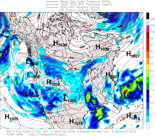
So as far as our next rain chances goes, our next rain chance comes in during the Second half of our work week this week. All of you know I generally study 3 different weather models that I tend to find most accurate for my predictions on what I think is going to happen. The GFS (Global Forecasting System) weather model is one, and it shows a disturbance moving from the west coast, making it's way to us by overnight Wednesday and into Thursday. This particular Weather model shows rain throughout the day Thursday mostly Moderate in coverage, and clearing out by Thursday night, maybe Friday morning for east Arkansas. We are clear for Friday and most of Saturday, then our next weather maker moves in on Sunday.
So as far as our next rain chances goes, our next rain chance comes in during the Second half of our work week this week. All of you know I generally study 3 different weather models that I tend to find most accurate for my predictions on what I think is going to happen. The GFS (Global Forecasting System) weather model is one, and it shows a disturbance moving from the west coast, making it's way to us by overnight Wednesday and into Thursday. This particular Weather model shows rain throughout the day Thursday mostly Moderate in coverage, and clearing out by Thursday night, maybe Friday morning for east Arkansas. We are clear for Friday and most of Saturday, then our next weather maker moves in on Sunday.
Here's the GFS Weather Model by Thursday Evening, this particular model has the bulk of the rain moving through and out by Thursday Evening and Night. Clears out by Friday morning, and we are clear from Friday-Late Saturday Night.
Here's the Next Weather Model I tend to study a lot is the NAM (North American Model). This is the exact same time frame on Thursday evening, and it shows the same thing. Only difference between this and the GFS is that this model is heavier with the rainfall, which does NO good to the flooding that we already have. Fortunately while this will be rain, I do not think it will add to flooding totals by much due to the speed of this system.
Now the Last model that I tend to study a lot is the GEM weather model, it's a Canadian model, but at this point it's showing the same as the other two. Now the GFS ALWAYS show snow in the long range, but it shows our next chance of rain (Sunday Evening/Night) as frozen precipitation. I DO NOT for one second buy into this, the GFS always does that. But Aye who knows it is Arkansas after all! But anyways, just to recap, Rain Thursday Morning-Evening, no severe threats, just rain. Then More rain Late Sunday and into Monday!
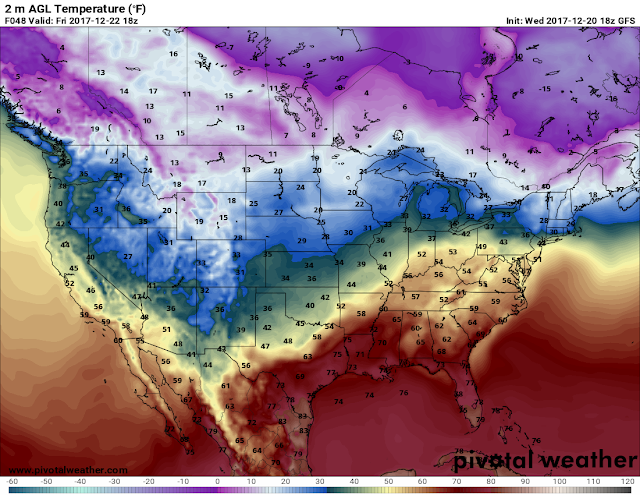
TEMPERATURES WILL BE COLD....... DRESS FOR WINTER. I'll keep you guys posted on here and social media, have a Nice Morning/Day Ladies and Gentleman!!
Follow Me On Social Media
TheArkansas WeatherHawk - Facebook
@OmarrWilson - Twitter
The Arkansas Weather Hawk - Google Plus


No snow? 😢
ReplyDeleteNo snow? 😢
ReplyDeleteSorry for the late reply, but nope, I don't think we will get any snow. I mean it is Arkansas right. This weather is nuts right. So I can't say it's impossible, but I don't think we will. The GFS always shows snow in the long run, usually it changes in 2-4 days, but we will see.
Delete