3 Shots at Rain, 3 Shots of Winter!!!
GoodMorning Everybody, hope you all had a warm and safe night. Following our last shot at some winter weather, which we ended up getting some good flurries mixed with the rain as far south as Conway and down to West Little Rock. I did not expect that to happen, I knew it could, but I had my doubts. But following that I've been watching the Long and now the Short range models at other chances further into the future. We have 2 disturbances, and one low pressure system to deal with, long and short range into the future.
The CMC aka "GEM" (Canadian Weather Model) is a long range model, this particular model picks up on a disturbance this weekend Saturday and into Sunday, most of this particular disturbance goes south of Arkansas, but some models project the northside of that disturbance to move through south and central Arkansas bringing us precipitation, a mixed bag of it. This model flings it south.
The NAM (North American Model) also picks up on the same Wave of Moisture this weekend, and also flings it south. The NAM is a short range model, so it doesn't go out past Sunday.
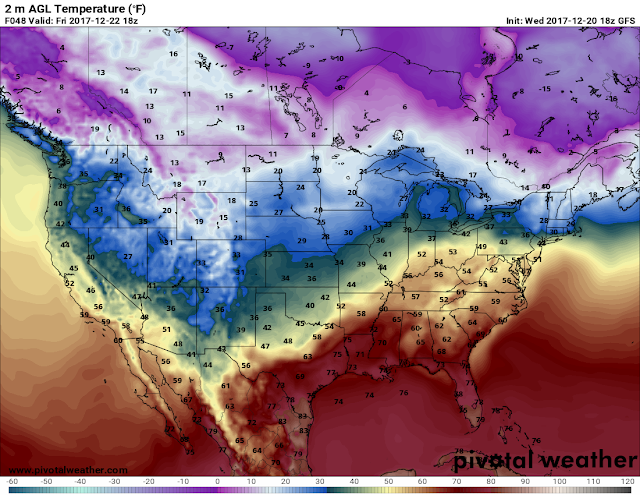
Now the GFS (Global Forecasting System) picks up on the Same wave of moisture this weekend, and brings it into central and south Arkansas as Sleet/Rain. Now past that, the GFS picked up yet another disturbance next Tuesday and Wednesday, the GFS has this sysem coming in overnight Tuesday and into Wednesday morning, the GFS has the 32° Line draped over central and north central Arkansas, which could mean Snow for north Arkansas, and a mixed bag in central or north central Arkansas.
Here's a picture of the GFS this is the Thursday the 14th 06z run of the GFS. It's this morning's set of data, is what that means. Here is the disturbance I was talking about overnight next Tuesday and into Wednesday. This is by 6am Wednesday morning the GFS has that 540 (32° "Rain/Snow" Line) draped across north central Arkansas setting the stage for Snow North, Mix in North Central/Central Arkansas. The 06z run of the CMC haven't come in yet. So the GFS is the only Fresh data I have to show on this.
Now getting to our last chance for rain late next week, there will be a Low pressure system moving through the state, it will bring moisture along with it. The GFS is cold on it, in which it always is in the long range, but however, there is another chance of Winter Precipitation on the Backside of that system as it moves through, so we'll have to watch that as we come into early next week.
Now for the stuff next week, it's Thursday, this is a long ways off. LOT'S if not ALL of this information can and will change, so just stay tuned I'll bring you updates as it does. It will rain on Friday (Tomorrow), hit and miss chances of rain showers. As far as Saturday, one model brings mixed stuff into central Arkansas, one model brings Rain, another model brings nothing, we'll have to wait and get closer in time to see if stuff line up. Next week's stuff will change, but there will be chances of precipitation of SOME TYPE if not all types, but take that with a grain of SUGAR!!! I appreciate you all for coming here to the Weather Hawk's Blog, have a GoodMorning Everybody!! 👋✌
Follow Me On Social Media
TheArkansas WeatherHawk - Facebook
@OmarrWilson - Twitter
The Arkansas Weather Hawk - Google Plus


Comments
Post a Comment