WINTER WEATHER UPDATE 1/20/16
GoodMorning Everybody! As I went to bed last night I figured the interesting weather would be moving through right now (5am-7am), but the bulk of the precipitation moved through JUST before I woke up shortly before 4am. As Expected for the most part everything from Little Rock on South was Rain. Everything North of Little Rock was Frozen mostly. So everything happened pretty much as expected. Problem is, the temperature has dropped below freezing here in West Little Rock so the wet roads may start to freeze on bridges and overpasses or ALL ELEVATED surfaces.
Now getting past that and on to our next big weather maker. Our next shot at Winter Weather is LATE Thursday Night and Friday Morning. What I expect, the rain moves in on Thursday, initially the only frozen precipitation is expected to be in NORTH ARKANSAS at the On-set of everything. Now as the Thursday night moves on the temperatures will start to drop here in Central Arkansas and a Changeover from Rain to Sleet will occur. Now as the temperatures tank, we may see a BRIEF changeover to Freezing Rain, then to Sleet. Everything should then changeover to all Snow on the backside of the system as it pulls away on Friday Morning.
Now when it comes down to accumulations, it's only Tuesday, it's too early to put a number to it, but based off of what I've seen in the Weather Models the Snow will be Moderate to Heavy snowfall, AND it will fall at a Steady pace for a few consecutive hours!!!!!!!! So what does that mean?? Well it means that there is a good chance AT THIS TIME to see MEASURABLE Snowfall here in Central Arkansas!!! For All of You Kids, If I had to guess, you can pretty much start to anticipate Friday to be a SNOW DAY!!! I KNOW You guys Love to hear that! Now Keep in Mind that it's only Tuesday, this forecast MAY CHANGE, nothing is WRITTEN IN STONE!

Now what you're looking at here is the GFS (Global Forecasting System) Weather Model by 6am Friday morning, it shows a change over from Rain to Sleet here in Central Arkansas. Now we are looking at this system after a full evening of rain as it pulls away. Rain changing to Sleet, and possibly Freezing Rain before sleet by EARLY FRIDAY MORNING..... So if You Have to Work Friday You definitely want to monitor my forecast for possible changes.

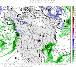
Alright what you're looking at here is the GFS in between the time period of 6am-12noon on Friday. So this is that time frame from Early Friday morning to Noon on Friday. Moderate to Heavy Snow moving through Central Arkansas.. This is where our accumulating snow will come from. During this time frame we COULD pick up an inch or two of snow! Well I'm just going to say MEASURABLE Snow. So by Friday morning You could be waking up to Snow. IT'S STILL TUESDAY, So take that With a Grain of Salt!!
So everybody, as you hit those highways this morning on the way to work and school, DRIVE SLOW AND BE VERY CAREFUL!!!! Those Highways are Wet, and it's below freezing, there could be Ice Patches in spots, especially on Bridges and Overpasses! USE EXTREME CAUTION!! Thanks for Coming here to the Weather Hawk's Blog, I'll keep you all posted on any changes with the Forecast!
Follow Me On Social Media
TheArkansas WeatherHawk - Facebook
@OmarrWilson - Twitter
The Arkansas Weather Hawk - Google Plus


Comments
Post a Comment