Posts

Showing posts from April, 2018

**SEVERE WEATHER UPDATE** Frightening Friday Weather Coming
Image
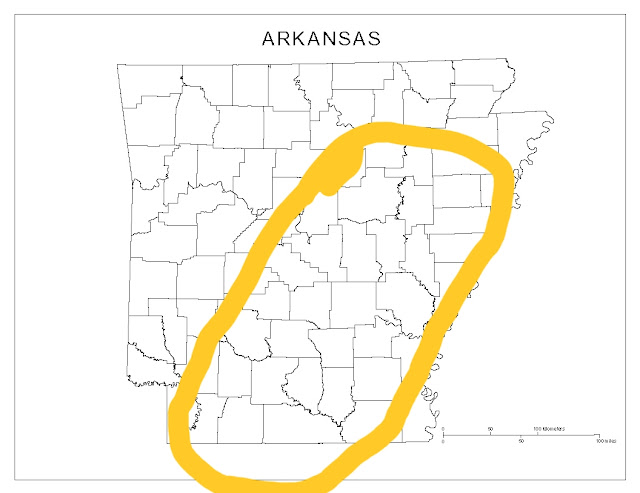
      Hey Everybody, how's it going on this Thursday night. Unfortunately a harsh reality of spring in Arkansas is Severe and potentially Deadly weather. Tomorrow is one of those days where we will definitely have some of that weather. Now this will be a very typical spring severe weather set up for Arkansas. We will have a front moving in with a certain amount of instability which will be sufficient enough for Supercell thunderstorms to develop, and rotate, and produce tornadoes. Now down to the meat and potatoes.........       What everyone wants to know is what are the risk for tomorrow.? Well at this point EVERYTHING is a risk, Wind, Hail, Tornadoes the whole 9! I think the area with the Highest chance of Severe Weather is this outlined area below: If you live ANYWHERE in that outlined area; I expect Severe Supercell Thunderstorms, I expect storms with Strong Winds, Large hail, and large violent Tornadoes ARE POSSIBLE in that outlined area! Thi...
More Severe Weather Ahead

Image
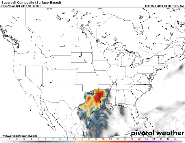
      Hey Good Evening everybody, how's it going!? I've been looking over the model data from the NAM and the GFS weather models, and it looks like there's yet another chance for Severe Weather on the horizon! I don't think this will be as widespread as the most recent Severe Weather event we had yesterday. But it will be something to watch for Southwest Arkansas.       This system will be in the form of a Squall Line with moisture streaming in from the south on Friday. Now with this it seems that earlier into the evening the chance for Tornadoes and Supercell thunderstorms is confined to Southwest Arkansas. However the threat for strong winds, and large hail is statewide as that Squall Line moves through later in the night on Friday. See Pictures Below: This is the noon run of the NAM. This map is valid around 6pm Friday evening, as it shows the area with the highest probability of severe storms is in the West/Southwest corner of the state. This i...

**SEVERE WEATHER UPDATE** Monday Madness

Image
     Hey Good Afternoon everybody,  how's it going!? Unfortunately the time has come for a threat of more Severe Weather here in Arkansas. The particular area of the state that I'm expecting to see the worst of the weather has already seen their fair share of severe weather this year already, and the season just got kicked off! East, and Northeast Arkansas. Areas to the East along, and to the North, and South of Interstate 40, generally East of the Little Rock metro is where I expect majority of the bad weather to be confined to.... This is based off of just timing of the Front itself! See Pictures Below: Okay this is the Latest Run of the NAM (North American Model) this map is Surface Based Instability, this is around 6pm tonight and as you can see the instability is confined to areas north and south of Interstate 40 in East Arkansas. This is where we find our greatest chances for Severe Storms. This is the NAM Tornado Map this is where the model guesstimate...