Posts

Fall Severe Weather Season AWARENESS

Image
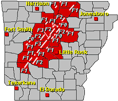
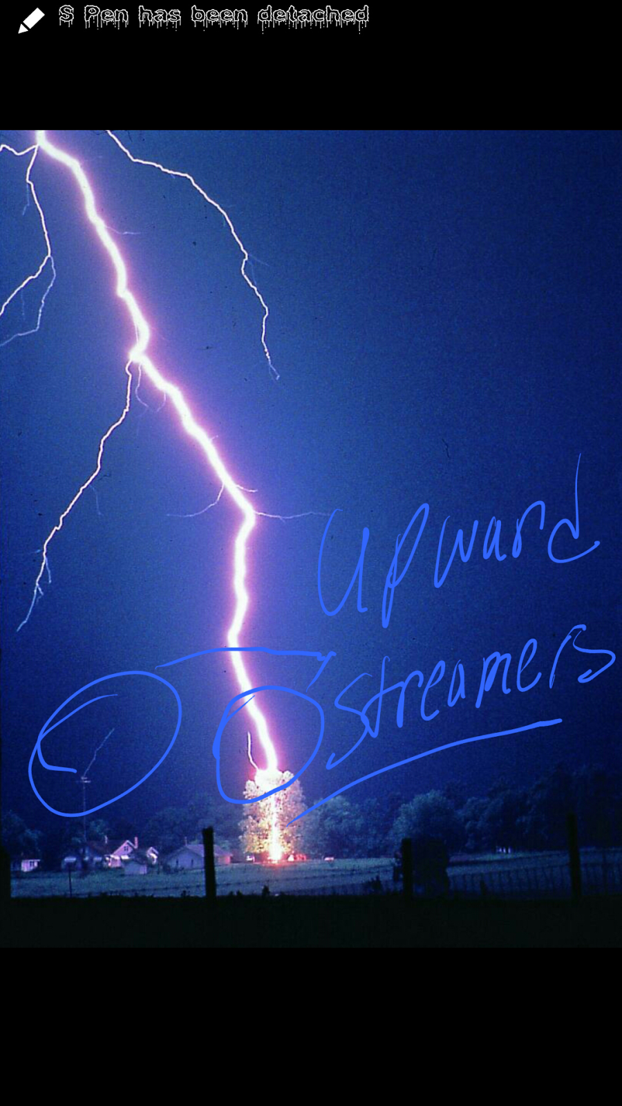
           It was nearly 5 years ago back in 2009, the state of Arkansas had its most active fall severe weather season to date. With 15 Tornado Reports and about 22 Severe Weather Reports, needless to say it was a pretty active fall. Fall Severe Weather season here in Arkansas typically runs from Sometimes Late September all the way through early December. Fall Months can be just as violent as spring months, and has been in the past. All due to similar climate conditions in both the season of spring and fall. Now 2009 was the most active in recent history for Arkansas. But 2012 wasn't very far behind with 13 Tornado reports mostly in October and November. I'm not saying this year (2014) will be like either of those years. I just want it to be known that Tornadoes can and do happen in the fall months before winter. So just like you do in the spring, take the warnings and notices VERY serious because here in Arkansas just like anywhere else, it could mean th...

More Severe Weather?

  Heyy everybody how's it Goin!? Arkansas Weather Hawk here. Just letting you guys know that these little "sprouts " in severe weather that we've been having lately, they are to be expected. You see, here in Arkansas we have not One, but Two different Severe Weather Seasons in which those times are very conducive for Severe Weather, and Tornadoes. Here in Arkansas some of Our most dangerous of Tornadoes has happened in the fall. Our "Secondary Severe Weather Season " generally runs through the fall months of Late September through Mid November. As the climate transitions from Fall to Winter, that environmental setting is nearly Identical to our Spring Setting simply because Spring and Fall are What I like to call "Transition Seasons", so their very similar in terms of how the climate is set up. So just like Spring is prime time Severe Weather and tornado time. Fall can be just the same. So as we move into our Secondary Severe Weather season beware ...

2014 Fall&Winter (Initial Thoughts)

     Heyyy Everybody, How's it Going? Today's Update is just meant to share my first thoughts regarding this year's fall and winter. Now later on I'll upload a indepth analysis of how I expect the winter and fall to play out. But upon first Thoughts. I'm thinking this will be a more cooler and possibly wetter fall than average. Due to our incredibly unusual summer we've had. Our summer has been both cooler and wetter than average, and we ended up breaking a few records this year because of that. Now the way the summer goes generally tend to set the vibe, or dictate a lot abt how the winter will go. If it's a summer where we've gotten days of 100°+ temperatures. Then we'll ether get a late winter or alot of Ice. If it's a cooler summer then it's a cold potentially Winter Storm Type winter. And that's the Vibe that's coming off of this years summer. Simply because the ground has practically No leftover heat from the summer. So when it g...

What Actually Causes And Actual Lightning Flash??

Image
        Okay Guys,  so remember Yesterday I talked about the Birth of Lightning. Stepped Leaders, and Upward Streamers. I talked about what has to happen before a Bolt of Lightning to happen. Now as for a Lightning Strike itself. How does That Process Work? Well The entire Stepped Leader Process happen. Now once the Stepped Leader and Upward Streamer actually meet, In which they generally tend to meet about 30-40 meters above the Ground,  I call this the "Point Of Contact" see Below Now once this Point of Contact is established, at this point there is a clear link between the cloud and the ground (Electric Wise)  this is a clear Path for the Lightning Strike to take through the air. So after this point there is what meteorologist call a "Return Stroke". See the Negative Charges have already dispersed from within the Cloud base through the Stepped Leader Process. Remember they couldn't handle all that charge. So Now at this point, the Build Up of...

Stepped Leaders, Upward Streamers (The Birth Of Lightning)

Image
             Okay everybody as stated last Night in my Facebook and Twitter Update I said that I was doing a 4 day special on Lightning Awareness. To kick everything off, I'll begin with the birth of lightning. How it all begins. Make sense right?      So first things first, how it all starts. Raindrops  within a Thunderstorm cloud collide together,  clump together, and fly past each other at high speeds due to the winds up there. All of this movement creates a negative charge with the cloud itself. The positive Charges go to the very top of the cloud because there are positive charges on the ground. And the positives within the cloud wants nothing to do with that. So they run to the very to and the negative charges sink to the bottom like hot water in the tub. Now as the negative charges at the bottom of the cloud build up positive ions on the ground start to build. As the positive charges on the ground build they tend to at...

MidWeek Rain

To say the least.  It's Going to Rain Like Hell over the next Day and a half to two days. I will have a Full Update about it first thing in the morning! #IPromise #ARWX

Hit&Miss Summer Showers

           These hit and miss showers, and popup summer thunderstorms tend to be pretty violent at times. They will cycle and die out when the sun goes down and they lose the heating of the hot summer afternoons. But while the storms are in their prime they can become quite strong. Not Severe type strong but when it comes down to driving and traveling in one of them it can be quite bothersom. Flash flooding tends to become a threat as these storms can dump lots of rain at one time in one area. That raises the flash flooding concern. Best advice would be to just hunker down and stay indoors while these storms move thru. Lightning is also something else that should be watchedvery cautiously.  Lightning is the number 1 killer in nature.    I am the Arkansas Weather Hawk. I appreciate you guys for choosing me to be your go to guy for Severe Weather information.