Severe AND Winter Weather Update 12/13/2016
Hey Everybody, How's it Going!! We have A lot to cover so I'm warning you now, this will be a lengthy Update.! So lets get right into it. This Past Weekend after all of our nice rain, we didn't get much in the way of flurries or snow at all, which was to be expected. But Saturday the Models started hinting on Possible Snow Next Weekend. Some Forecasters got all in a tissy on Social Media then people started talking about "Snow" for NEXT weekend which was THEN 7-8Days away! Let me tell y'all something people, NEVER, and I do mean NEVER BELIEVE a Person be it a Forecaster or any Weather Source when they say "There's a chance for Snow", But that Chance is 8 DAYS AWAY! Long Range Forecasting (Beyond 3-5 Days) is NEVER set in stone. Weather Models go as far out as 12 Days but Only the first 4 days of them are Credible You Understand me? So If it's beyond that 4 day period it's ONLY SPECULATION!!!!!!!! REMEMBER THAT!
Now that I got that out. Temperature wise, we will ride a Roller Coaster, it will be Mild 50s Thursday and Friday on into the Weekend. Then Friday Night Golf Temperatures will filter back in and we'll warm into the 60s possibly on Saturday. Now with Golf Temps filtering in, and a Strong Storm System bringing Artic Air behind it, That CLASH in the Air Masses will set the Stage for Strong to Severe Thunderstorms on Saturday Morning, Afternoon, and Evening. This is a Powerful Storm System Pushing in so the Chance is ESPECIALLY there for Hail and Damaging Thunderstorms. BUT there is ALSO a Slight Chance for ISOLATED Tornadoes.
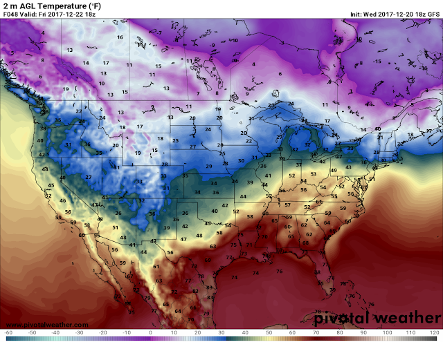
NOW, with that Said, the Chance for Tornadoes are Few and Far Between with this Setup, BUT THERE IS STILL A CHANCE!!! Now This Chance for Severe Weather looms out Ahead of the Front and Along the Front........ But BEHIND THE FRONT, Cold Arctic Air will be Pusing in behind it (This will be one of those cases where Brinkley Arkansas is at 60° in front of the front, and Carlisle Arkansas is at 40° behind the front... That's called a "Temperature Gradient" and when the distance in change in temperatures are that close that means it's a STRONG/STEEP GRADIENT). BEHIND the Front, on the backside of it after it moves through there will be Both Subfreezing Air, AND Wrap Around Moisture. So that Introduces us to the Possibly for SNOW!
Okay Now Let's put all of this Into Perspective, Mild Temps/Uneventful thru Friday. Warmup Friday Night into Saturday, Thunderstorms Possible Saturday.
Now that I got that out. Temperature wise, we will ride a Roller Coaster, it will be Mild 50s Thursday and Friday on into the Weekend. Then Friday Night Golf Temperatures will filter back in and we'll warm into the 60s possibly on Saturday. Now with Golf Temps filtering in, and a Strong Storm System bringing Artic Air behind it, That CLASH in the Air Masses will set the Stage for Strong to Severe Thunderstorms on Saturday Morning, Afternoon, and Evening. This is a Powerful Storm System Pushing in so the Chance is ESPECIALLY there for Hail and Damaging Thunderstorms. BUT there is ALSO a Slight Chance for ISOLATED Tornadoes.
This is a Screenshot of the GFS (Global Forecasting System) Weather Model Picking up some Instability in the Atmosphere in between 6pm Saturday Evening and Midnight Sunday Morning in East Central Arkansas (Little Rock on East will have to be Watched for Severe Weather Saturday Evening.)
Okay Now Let's put all of this Into Perspective, Mild Temps/Uneventful thru Friday. Warmup Friday Night into Saturday, Thunderstorms Possible Saturday.
National Weather Service has this Area of the State Outlined for the Risk of Severe Weather Saturday Afternoon and Evening. I Posted a Map Above basically Outlining the Same Area.
Then On the BACKSIDE of The Storm System The Wrap Around Moisture will Refreeze giving us a Chance of Snow Saturday Night and Sunday Morning.
This is Saturday Night Courtesy of The National Weather Service In North Little Rock, They Made this. After the Main Front has Moved through, There will be Freezing to Subfreezing Air and wrap around Moisture.
Last Map Courtesy Of The National Weather Service in North Little Rock, This is After Midnight Sunday Morning! IF THERE IS ENOUGH MOISTURE, the Air will be Cold Enough for a Complete Changeover.
THERE IS NO SPECULATION on Any Possible Accumulations or How this Will Impact Travel, or even WHERE isn't clear yet! To Early to Tell. Its Only about to be Wednesday! A LOT CAN AND WILL CHANGE! THIS IS NOT SET IN STONE!!! I'll Update again with ANY CHANGES I SEE FROM HERE ON OUT! Thanx For Coming to The Weather Hawk's Blogg Everybody!
Follow Me On Social Media
@OmarrianWilson - Facebook
@OmarrWilson - Twitter
@The Arkansas Weather Hawk -Google Plus


Comments
Post a Comment