Severe Weather Update: Sketchy Weather Saturday
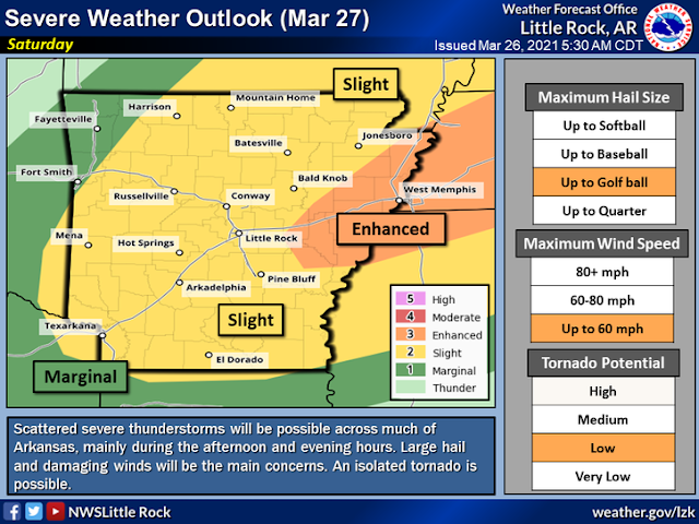
Hey Everybody how's it going!? I hope everybody is safe, enjoying this beautiful spring weather. Speaking of the Weather, we have more severe weather coming in. There is a Chance for more Severe Weather Saturday Night in the State associated with a Front moving through, there will be a lot of wind energy associated with this front. This system won't have a particularly high amount of Instability with it, but it will be a lot of Wind Shear (The Turning of Wind with Height). So even in a Night-time environment, Storms will still have the ability to develop and rapidly become severe.
Storm Prediction Center in Norman Oklahoma, has already issued a Slight Risk area for majority of the State with an Enhanced Risk for East Arkansas. An Enhanced Risk is an area of heightened concern within a general area.
The Main Threats here are Wind, and Hail, the Risk for Tornadoes is Definitely there, but I don't expect a Major Outbreak of Tornadoes. But, if a Storm Does get Organized, it will pose a Tornado Threat. Make sure You State Tuned to The Arkansas Storm Spotters on Facebook, and Follow The Arkansas Weather Hawk's Den for Back to Back Weather Updates. A Tornado Watch for a Major part of Arkansas will likely be Issued Saturday Afternoon for Saturday night in advance of the Storms.


Comments
Post a Comment