More Active Weather?? Dehydrated Fall? What's going on?
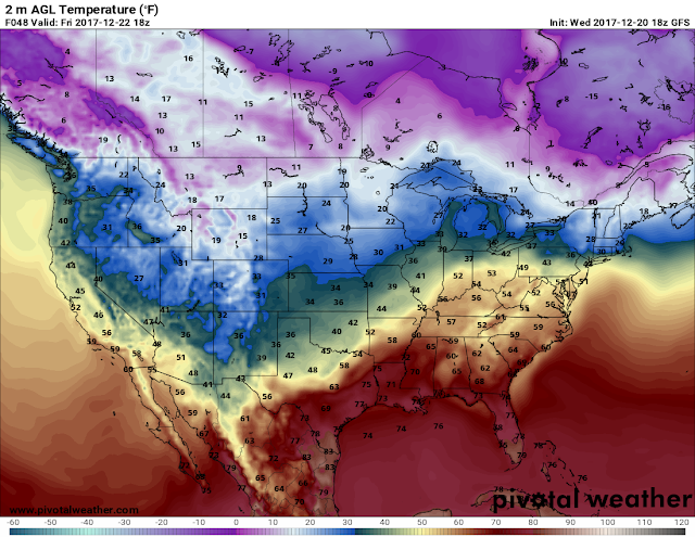
Hey everybody, how's it going !!! Man this has been One DRY Season aye!! We haven't had very much rain since Early September! High pressure set's up and it's resilient, it hates budging! But now that the climate is now starting to switch into a cooler more Fall/Winter feel/vibe the rules to the game are changing. We have a Low pressure system that's making it's presence known in more ways than one! First, this system is bringing the FIRST BLIZZARD of 2016 to the Central United States Plains. Montana, Kansas, Nebraska, and South Dakota are in the cross hairs! Now we will be on the Other side of the stick when it makes it out this way! We won't get no snow, but what we will get is a broken Line of Showers and Thunderstorms Late in the morning on Friday (Tomorrow), SOME OF THOSE STORMS COULD BE STRONG!
I Do Not Foresee a threat for Tornadoes or anything like that at this point. I do however, expect there to be some type of Strong Wind Threat present, this will be a fast moving storm system, so any Strong Storms that does develop, I do expect them to pose an Isolated Wind Threat. DO NOT BE SURPRISED if You see a couple Severe Thunderstorm Warnings or Three. There is a Hail threat, but more of a Wind threat than anything else. But this storm system will bring us some MUCH NEEDED rain. Not much rain because this will be a fast moving system. In around mid-morning for West Arkansas, Noon for Central, and Leaving East Arkansas before 5pm likely. Not an all day thing, NOT a Washout. Quick Storm system, boom bang boom, and it's out of here.
As far as my predictions for the remainder of the fall, we've seen our FIRST FREEZE already, and it's not Thanksgiving quite yet! This will be a cold one, but a fairly dry one. But along with that comes it's own set of problems!! That's a Monster for a different day! I thank and appreciate you all for taking the time out of your night to read this! THANK YOU! GoodNight Everyone!
Follow Me On Social Media
Omarrian Wilson -Facebook
@OmarrWilson - Twitter
The Arkansas Weather Hawk - Google Plus


Comments
Post a Comment