Developing Winter Weather Update: Polar Vortex is Coming!!
Hey Everybody! I hope everything is going well with everyone, and I hope everybody had a safe Thanksgiving and Black Friday Holiday! The weather was pleasant on Thanksgiving, was a bit on the cool side Thanksgiving night, I saw some sprinkles in spots around Central Arkansas, but nothing else remarkable, which was good. The Weather Models have flopped a little bit regarding this upcoming Winter Weather situation that I cover in my previous Weather Update.
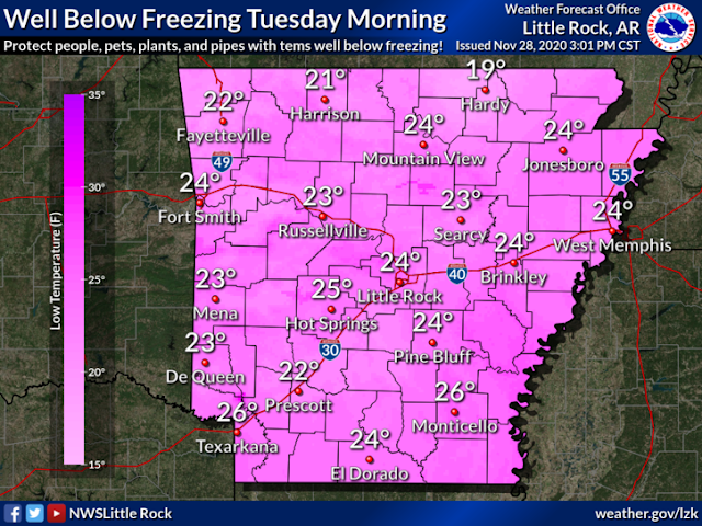
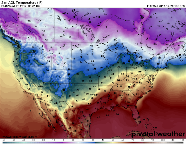
Now 2 days ago, I made an update sharing my predictions based on the GFS Weather Model. In that update, the GFS noted Freezing Temperatures in Central Arkansas Monday-Thursday of next week. Over the last few Model runs, the GFS and EURO have both warmed up on Wednesday, and both models are consistent on Mid - Low 30s Monday, Tuesday, and Thursday Mornings of next week. At first there were some talks about the Possibility of Some scattered Wintry Precipitation on Monday Morning, but that chance is highly unlikely at this point. Now the Latest Runs of the GFS Looks cold on Monday Morning with temps in the mid 30s in Central, Low 30s in North Arkansas. But, on Tuesday, both the GFS and the EURO looks Cold on Tuesday Morning for majority of the state. Now the GFS has temperatures at 32 degrees on Tuesday morning, realistically the temps can be anywhere around 32 degrees, maybe below or above by 1 or 2 degrees. The Newest run of the EURO is in the Mid 20s In Central Arkansas on Tuesday Morning! If this verify, then we could be in store for some seriously cold temperatures, like PIPE-BURSTING Cold Temperatures. The National Weather Service is rolling with the EURO, I'm not exactly sold on it just yet. Maybe if the EURO say this over the next 2 Model Runs, then I may get excited.


Comments
Post a Comment