November Arkansas Severe Weather Update: Secondary Severe Weather Season
How's it Going everybody!? I hope all is well, and everybody is staying safe out there! Here in Arkansas as some of you know, we have Two primary Severe Weather Seasons. We tend to see Severe Weather mors commonly in the transition months when the atmosphere transitions from Cold to Hot, Hot to Cold. The Transition of the atmosphere tends to create a lot of instability with frontal systems that move through, unstable climate conditions create lot's of "Wind Shear" (Turning of the Wind with Height,) thus giving incoming storm systems the leverage to rotate, or produce lot's of Severe Thunderstorm force winds. It's not uncommon here in Arkansas for us to see Tornadoes on Thanksgiving, and Christmas. Halloween is usually cold, and damp, but Thanksgiving and Christmas isn't uncommon to have Tornado Sirens and Lightning around here. So that being said, we are only just a couple of weeks away from Thanksgiving, and here we have today, November 14th, 2020, a chance for Severe Weather, and maybe an isolated Tornado.
 This is Courtesy of the National Weather Service, this is a risk Outlook map of the Risk for Severe Weather in the State, and Where?. As Described in the Map, the Highest Risk for Severe Weather is in Northwest, and Western Sections of the State, and Central Arkansas as well. Once this front hit West Arkansas, it will bring lots of wind energy with it, a lot of that will linger into Central Sections of the state. By the time this reaches East Arkansas, the line of Storms should be weakened by then.
As far as Timing goes, the Latest Run of the Weather Models places this Storm system moving through Central sections of the state around Midnight Sunday Morning. If there is Severe Weather in the State Overnight, that's cause for some obvious concern due to the fact that many people can be potentially caught off guard by unexpected dangerous weather. A vast Majority of people killed by Tornadoes, and Straight Lined winds are killed at night during Nighttime Severe Weather Events due to being caught off guard. When there's a chance for Severe Weather, always have a NOAA Weather Radio close, and always have a TV on or a Cellphone nearby. Always have a way to receive warnings, so that you're not caught off guard.
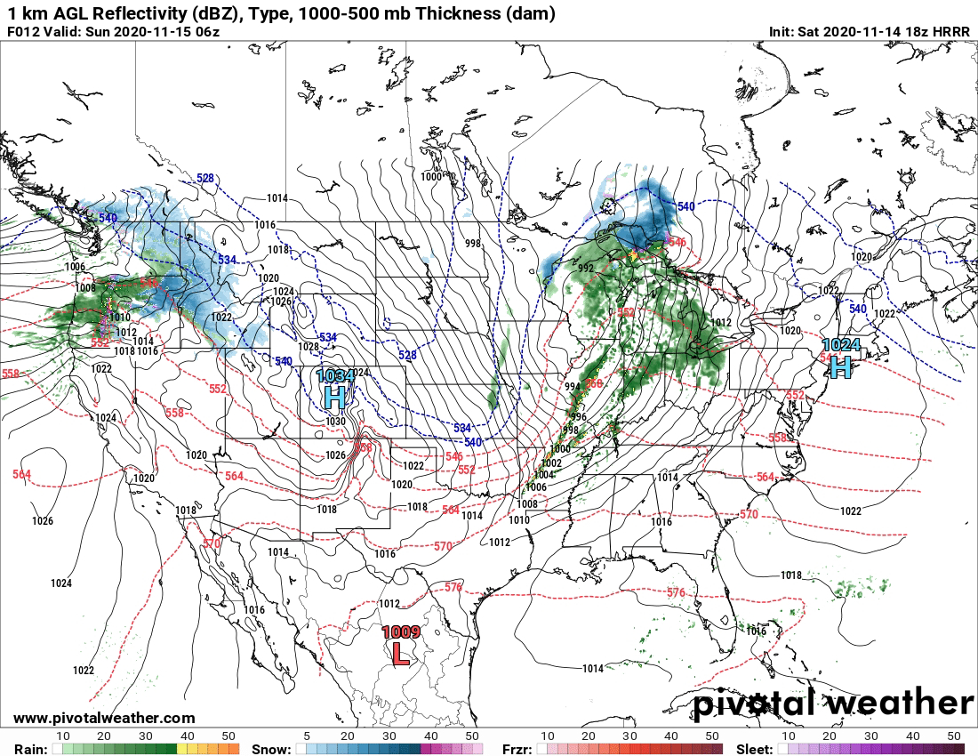
This is an Image of the High Resolution Rapid Refresh Weather Model, this model paints a picture of timing, and around what time frame we can expect Severe Weather in Central Arkansas. So between the Hours of 9pm and Midnight tonight is when we can expect the development, and Intensification of Severe Storms, including the chance for Tornadoes.
At the Current time of me doing this Severe Weather Update, the Storm Prediction Center in Norman, Oklahoma has issued a Tornado Watch for Northwest, and North Central Sections of the State until 12am Midnight Sunday Morning. This means that in between now, and Midnight tonight, there will be a chance for Severe Storms, and Tornadoes associated with those storms.
IF YOU LIVE IN NORTHWEST, WEST, OR CENTRAL ARKANSAS, STAY WEATHER AWARE MOVING INTO THE OVERNIGHT HOURS FOR POSSIBLE DEADLY WEATHER!!!


Comments
Post a Comment