Posts

What Actually Causes And Actual Lightning Flash??

Image
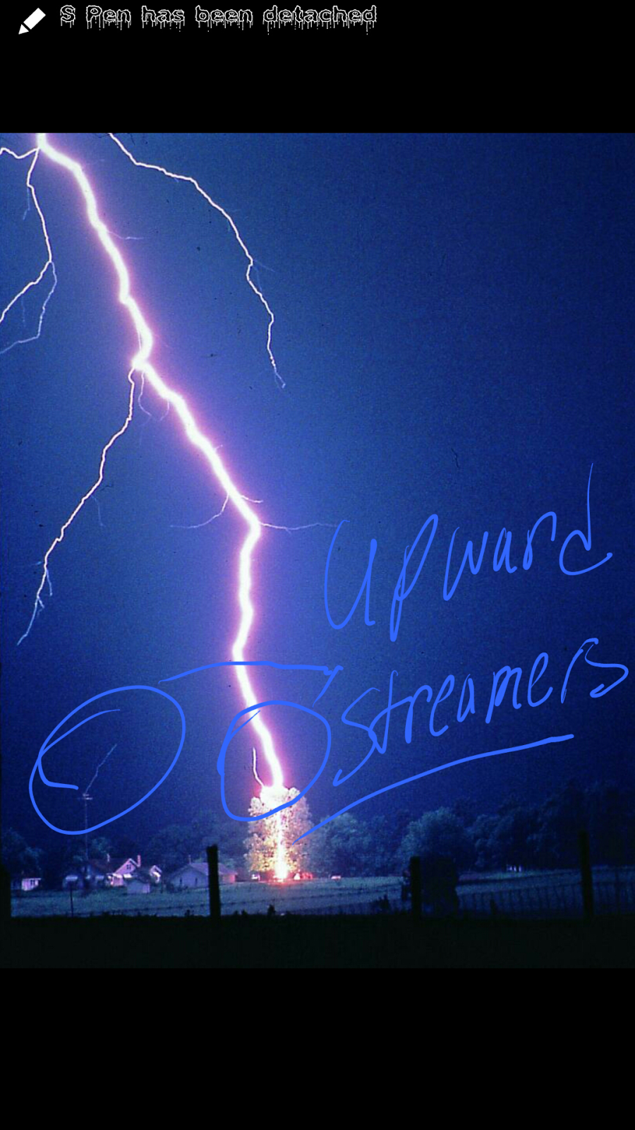
        Okay Guys,  so remember Yesterday I talked about the Birth of Lightning. Stepped Leaders, and Upward Streamers. I talked about what has to happen before a Bolt of Lightning to happen. Now as for a Lightning Strike itself. How does That Process Work? Well The entire Stepped Leader Process happen. Now once the Stepped Leader and Upward Streamer actually meet, In which they generally tend to meet about 30-40 meters above the Ground,  I call this the "Point Of Contact" see Below Now once this Point of Contact is established, at this point there is a clear link between the cloud and the ground (Electric Wise)  this is a clear Path for the Lightning Strike to take through the air. So after this point there is what meteorologist call a "Return Stroke". See the Negative Charges have already dispersed from within the Cloud base through the Stepped Leader Process. Remember they couldn't handle all that charge. So Now at this point, the Build Up of...

Stepped Leaders, Upward Streamers (The Birth Of Lightning)

Image
             Okay everybody as stated last Night in my Facebook and Twitter Update I said that I was doing a 4 day special on Lightning Awareness. To kick everything off, I'll begin with the birth of lightning. How it all begins. Make sense right?      So first things first, how it all starts. Raindrops  within a Thunderstorm cloud collide together,  clump together, and fly past each other at high speeds due to the winds up there. All of this movement creates a negative charge with the cloud itself. The positive Charges go to the very top of the cloud because there are positive charges on the ground. And the positives within the cloud wants nothing to do with that. So they run to the very to and the negative charges sink to the bottom like hot water in the tub. Now as the negative charges at the bottom of the cloud build up positive ions on the ground start to build. As the positive charges on the ground build they tend to at...

MidWeek Rain

To say the least.  It's Going to Rain Like Hell over the next Day and a half to two days. I will have a Full Update about it first thing in the morning! #IPromise #ARWX

Hit&Miss Summer Showers

           These hit and miss showers, and popup summer thunderstorms tend to be pretty violent at times. They will cycle and die out when the sun goes down and they lose the heating of the hot summer afternoons. But while the storms are in their prime they can become quite strong. Not Severe type strong but when it comes down to driving and traveling in one of them it can be quite bothersom. Flash flooding tends to become a threat as these storms can dump lots of rain at one time in one area. That raises the flash flooding concern. Best advice would be to just hunker down and stay indoors while these storms move thru. Lightning is also something else that should be watchedvery cautiously.  Lightning is the number 1 killer in nature.    I am the Arkansas Weather Hawk. I appreciate you guys for choosing me to be your go to guy for Severe Weather information.

Summer Arkaheat

        Hey guys how's it going! Just wanted to share some summer weather safety advice. Arkansas Heat can be Very dangerous in the summer time. And if you're not careful you can get heat exhaustion and pass out or even worse die from the intense summer sun. It's not as far fetched as it sound. Lots of people young people especially, tend to think that they'll be fine or simply not care. And that's a quick way of getting yourself hurt from the heat.     Advice- Drink LOT'S of Water or Liquids, Get Good or Decent Rest, Avoid going out during the hottest parts of the day, Do not Wear too many layors if you do go out, wear sunscreen. Exposed Skin can be painful in the hot sun. Get cool whenever possible. If at all possible help others that are not properly prepared for the summer heat.  Guys I appreciate you for choosing me to be your go to guy for weather information. I will do another post later regarding possible rain chances. So stay tuned. Y'all ...

Thunder Thursday

Image
      Hey everybody, how's it going. Well I neee to inform you about some severe weather that could possibly be moving into the state today. Now The Storm Prediction Center (SPC) In Norman Oklahoma has issued a Slight Risk Area for Severe Weather. It outlines the Southern 1/3 of the State. Little Rock and Surrounding areas included. Here's a pic of the risk area. Now The risk is for Hail,  and possible damaging Thunderstorm winds. Strong to Severe Storms basically. Now the tornado threat is low. But it is Arkansas so nothing is impossible. Just to clarify, a risk area is NOT a Watch of any type. It just tells you what areas the Storm Prediction Center will be looking at for Severe Weather and what type of severe weather they're looking for. As always thank you guys for choosing me to be your go to guy for Weather Information. Yall have a Very good day.!

The 2014 Hurricane Season

Image
       Well Guys as of June 1 we have started our 2014 Hurricane Season. That means that this is the time of year that Hurricanes happen here in the United States (Atlantic Basin) the most.  So that beggs the question. What will this year's hurricane season be like? Well a few different Variables determine this.  In this years case what is called "El Ninio". El Ninio is basically a certain atmospheric setup that usually shreads the tops of the thunderstorms due to really strong crosswinds aloft. Here's a picture of El Ninio conditions.   Those Crosswinds is known as Windshear. That difference in the wind aloft is the number 1 killer of hurricanes. Hurricanes cannot have any resistance to properly form and develope. When you get Warm waters. No Windshear. And Room to roam. Then you've got a hurricane on your hands. If you're missing anyone of those variables then you can forget it. According to the Weather Channel and NOAAS's outlooks on the 201...