SEVERE WEATHER UPDATE for Mother's Day Storms
Hey Everybody, How's it going! Hope everybody is having a SAFE Weekend so far. I'm doing this update at 10pm Saturday Night, I want to bring everybody up to speed on everything, and there has been some slight changes made to the Forecast. Okay ao first and foremost, The Frontal Boundary that's allowing all of this rain is still hung up in Oklahoma, I think it will be stalled until tomorrow night. So what this means for us here in Arkansas, well MORE Rain and Storms! The ground is INCREDIBLY saturated everywhere in the state. Some areas of the state have over 5inches of Rain!!!! &Unfortunately with this front taking it's time, it looks like we will add to those totals. So with all this rain in a short amount of time FLOODING becomes a MAJOR problem. Flooding kills more people than tornadoes AND lightning put together. This is because when people are driving they see standing water, and they don't think its that deep and they drive through it anyways, that water picks the vehicle up, sweeps you away, and you DIE. It sounds redundant, but that's LITERALLY how it happens. If you see Standing Water, or you live near a body of water, TURN AROUND Find another route, and Get out, Go somewhere SAFE. flooding, and water is No Joke. Water is a very POWERFUL Natural Force with no prediction, and it is completely Unstoppable, so do NOT mess with it !!! So as Far as Severe Weather, Flooding is the biggest Threat (Flooding is Considered a type of Severe Weather), but I do have additional concerns for High Damaging Thunderstorm Winds, and Large Hail. Also, the ground is soft, it's soggy, so large trees might become unstable. It only takes just a little bit of wind before large trees come crashing down after inches upon inches of rain. So just keep that in mind people!
.gif)

.gif)
.gif)
Okay so on Mother's day, in the early morning time hours there is a chance for scattered rain and thundershowers. But once all of that has moved out, I do think there will be a break in the afternoon hours, then Sunday Evening we will have another round of Strong to Severe Thunderstorms, and heavy rain. The Main threats will be Hail, Heavy Rain, and the Possibility of High damaging Thunderstorm Winds. There is a area of concern within that Slight risk area for Southwest Arkansas, going down I30 from Little Rock on Southward. Monday (Early) is when I expect the front to finally push on through and put an end to all this rain, and storms.
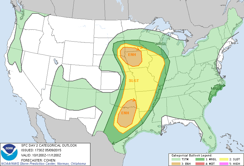
This is the Slight Risk area issued by the Storm Prediction Center in Norman Oklahoma, this is Valid for Mother's Day as these storms move in. They will be Strong to Severe. Again wind and hail are the main threats.
.gif)
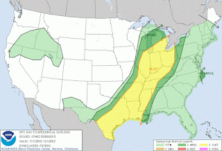
This is a Slight Risk for Severe Weather issued by Storm Prediction Center in Norman Oklahoma. This is Valid Monday for when that front FINALLY push on through the State. There is a risk for severe weather as that front moves through. The main threats are Heavy RAIN and FLOODING, strong possibility damaging thunderstorm winds, and Large Hail.
The Tornado Threat during the rest of this weekend is on the low side, I mean I cannot rule out a Tornado, its not Impossible, it's Arkansas. But that chance is pretty low.
Follow Me on Social Media
TheArkansas WeatherHawk - Facebook
@OmarrWilson - Twitter
The Arkansas Weather Hawk - Google Plus


Comments
Post a Comment