Developing Winter Weather Update: More Snow!! This Time for Central Arkansas!
Hey Everybody, How's It Going!? I hope Everybody is safe, and all is going well as we approach Christmas 2020! Like everything else this year, the weather has been on a true roll! I was dead on some updates ago when I released my official Fall Forecast, along with some Winter predictions, because so far this has been a very busy season for forecasters! From one possibility of Severe Weather, to Several Possibilities for Winter Weather, and so far Two Winter Weather events into the season! Now for the Third?
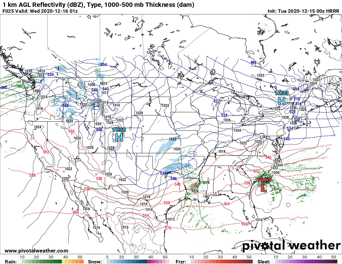


This is the HRRR (High Resolution Rapid Refresh Weather Model), this particular model is a 48 hour model, it tends to be fairly accurate, and dependable in the short range. According to this one Model, the Onset for Winter Precipitation in the state is between the Hours of 3pm and 6pm in the afternoon on Tuesday December 15th. But the Precipitation then starts to drift East into Central Arkansas around 6pm Tuesday Evening.
This is the HRRR Model at 8pm Tuesday Evening, and as you can see this particular Model is more aggro on the coverage of Winter Precipitation in Central and West Arkansas. If this is to verify, Central Arkansas will see some accumulations.
This is the NAM (North American Model), now this particular Image is valid between 6pm and 9pm Tuesday Evening, this model isn't as aggressive on Wintery Precipitation Coverage in the state.
This is the Temperature Map of the NAM, this is Valid Tuesday Morning between the Hours of 3am and 6am, the Temperatures hover around the Freezing Mark on Tuesday morning. I Wouldn't be Surprised if the Temperatures stayed at 32° ALL DAY! IF THIS IS THE CASE, THEN ANY WINTERY PRECIPITATION THAT FALL WILL STICK, THIS WILL CAUSE TRAVEL PROBLEMS DURING THE EVENING COMMUTE!!!!
The National Weather Service in North Little Rock, Arkansas has developed this map of possible accumulations based off the Ground Temperatures, and the amount of projected Winter Precipitation by the models, some isolated areas could see less or more.
The Problem that I have with this particular Setup is the timing...... All of this is set to take place during the rush hour time of the day, that puts a lot of people in vehicles at the same time during the day, when there's a chance for snow, or winter precips, that's a problem, especially for Arkansas. This particular state isn't known to have the best Drivers, so my concern is casualties on the roads due to people not driving with caution in inclement weather. This is a chance for Accumulating Snow in Central Arkansas, during Rush Hour......... Let that Sink in!


Comments
Post a Comment