Posts

Severe Weather SUNDAY: Severe Weather Update

Image
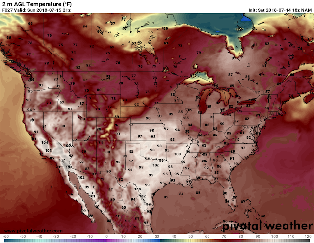
      Hey everybody, how's it going! This weekend there is definitely a chance for rain, there is somewhat a chance of Thunderstorms. With the cooler air forecasted this coming up work week, their will be a front associated with that air (it always set's up that way). But with the cold front coming, there will be storms along and ahead of it. That front will stall out across the state, this is what will allow the cooler temperatures to set in. But a line of storms, and a chance for severe weather comes with the front.       Okay, what am I expecting? With our weather for tomorrow, with the latest run of the models, I see a chance for Severe Weather to develop, and a chance for a Tornado or two ( THAT CHANCE IS LOW), but the chance for Tornadoes can never be ruled out! Tomorrow will be a mostly quiet day weather wise, with a chance for scattered rain up in the day. But tomorrow evening and night, I will be looking for Thun...

Polar Vortex Split!! Temperature CHANGE COMING!!!!

Image
       Hey everybody, welcome back to the good ole Arkansas Weather Hawk's blog, where you get the inside scope on what's going on with the bipolar weather in Arkansas! I don't know if some of you have heard of it or not, but we had what's called a Polar Vortex Split. What a Polar Vortex Split is; Is when the Low Pressure Cold air in the North Pole split into two sections of Cold air, when this happens the Jet Stream, which keeps the air trapped up in the Arctic North Pole, starts to wave, and dip down into the southern regions of North America which in turn brings us colder temperatures! Usually this has a tendency to happen during the Winter, but when this happens during the summer, it seems a bit weird, and it will bring us unseasonal temperatures. THIS SUMMER, WE NEED THAT! This is what a "Polar Split" looks like. Notice how the blue eventually floats over the United States? That happens when the Jet Stream weakens, and allow high pressure to develop, ...

Severe Weather Stat's, Tips, and FAQs

Image
      Hey everybody, How's it going?! I hope everybody is safe of this Saturday evening following Saturday morning's powerful storms that rocked parts of the Natural State. I wanted to do this update, because I've gotten tons of questions from people that have confused last night's wind damage to tornado damage. This is why people die, or get hurt during dangerous weather, due to misconceptions and myths, I want to clear some of that up in this post. Let me start by saying, straight lined winds can be just as bad as tornadoes. Straight Lined Winds can meet and exceed tornado, and possibly even hurricane force winds. ANYTIME you have winds moving that fast there will be damage, we all know that. But just because there is a Severe Thunderstorm Warnings in effect, that doesn't mean yo u should take it any less serious. Sometimes when I broadcast a warning on Social Media, I will go ahead and say " Get to a Safe Place", because I know that the winds this pa...

BEAT THE HEAT: Potentially Life Saving Advice

Image
     Hey Everybody, how's it going! I know it has been a while since I made a weather update. Mainly because we haven't had any particular weather anomalies that has prompted one. But, I'm extremely concerned about people actually knowing, or practicing heat safety. I mean really, in the wintertime you dress in layers right? Why do we do that? Because it's cold and we don't want to freeze to death. Well in the Summer, why is it difficult to wear light, and few clothes, and drink water? In the winter on a 20 degree day, we dress in layers and drink hot chocolate. but In the summer on a 100 degree day, we cut grass at 3pm in the evening and fall out in the middle of the yard..... That doesn't make any sense!! IF YOU MUST VENTURE OUTSIDE YOUR HOME In the Hottest parts of the day (12 Noon - 5pm) DRESS LIGHTLY, AND CARRY/DRINK LIQUID!!!!! Simple Instructions! If you're breathing hard enough to open your mouth and breathe, then you need a break!! This is the L...

**SEVERE WEATHER UPDATE** Frightening Friday Weather Coming

Image
      Hey Everybody, how's it going on this Thursday night. Unfortunately a harsh reality of spring in Arkansas is Severe and potentially Deadly weather. Tomorrow is one of those days where we will definitely have some of that weather. Now this will be a very typical spring severe weather set up for Arkansas. We will have a front moving in with a certain amount of instability which will be sufficient enough for Supercell thunderstorms to develop, and rotate, and produce tornadoes. Now down to the meat and potatoes.........       What everyone wants to know is what are the risk for tomorrow.? Well at this point EVERYTHING is a risk, Wind, Hail, Tornadoes the whole 9! I think the area with the Highest chance of Severe Weather is this outlined area below: If you live ANYWHERE in that outlined area; I expect Severe Supercell Thunderstorms, I expect storms with Strong Winds, Large hail, and large violent Tornadoes ARE POSSIBLE in that outlined area! Thi...

More Severe Weather Ahead

Image
      Hey Good Evening everybody, how's it going!? I've been looking over the model data from the NAM and the GFS weather models, and it looks like there's yet another chance for Severe Weather on the horizon! I don't think this will be as widespread as the most recent Severe Weather event we had yesterday. But it will be something to watch for Southwest Arkansas.       This system will be in the form of a Squall Line with moisture streaming in from the south on Friday. Now with this it seems that earlier into the evening the chance for Tornadoes and Supercell thunderstorms is confined to Southwest Arkansas. However the threat for strong winds, and large hail is statewide as that Squall Line moves through later in the night on Friday. See Pictures Below: This is the noon run of the NAM. This map is valid around 6pm Friday evening, as it shows the area with the highest probability of severe storms is in the West/Southwest corner of the state. This i...

**SEVERE WEATHER UPDATE** Monday Madness

Image
     Hey Good Afternoon everybody,  how's it going!? Unfortunately the time has come for a threat of more Severe Weather here in Arkansas. The particular area of the state that I'm expecting to see the worst of the weather has already seen their fair share of severe weather this year already, and the season just got kicked off! East, and Northeast Arkansas. Areas to the East along, and to the North, and South of Interstate 40, generally East of the Little Rock metro is where I expect majority of the bad weather to be confined to.... This is based off of just timing of the Front itself! See Pictures Below: Okay this is the Latest Run of the NAM (North American Model) this map is Surface Based Instability, this is around 6pm tonight and as you can see the instability is confined to areas north and south of Interstate 40 in East Arkansas. This is where we find our greatest chances for Severe Storms. This is the NAM Tornado Map this is where the model guesstimate...